Hydrography
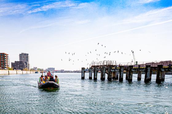
Ever dreamt of unravelling the secrets hidden beneath oceans, seas, and lakes? The Hydrography B postgraduate programme invites you on a journey to explore the fascinating world of underwater landscapes. As a hydrography student, you will collect and document vital data about water bodies, measure depths, chart submerged ridges, and reveal hidden sandbanks and wrecks beneath the surface.
Hydrography
Introduction
Hydrography is the science of measuring and describing the physical features of oceans, seas, lakes, and other bodies of water. Hydrographers determine water depths and locate underwater features such as ridges, banks, and wrecks. In addition, they monitor tides, currents, water levels, and physical parameters such as temperature and salinity. All this information is brought together in detailed hydrographic models that reveal the hidden contours of the underwater world.
The main output of hydrographic work is a detailed study of the seafloor including nautical charts, tidal predictions, and accurate volume calculations—essential for dredging and marine infrastructure projects. Data, collected from oceans, seas and rivers worldwide, is critical for merchant shipping, offshore operations, dredging, as well as environmental and underwater research.
The Hydrography Category B postgraduate is a unique programme in Belgium, developed by the Institute for Hydrography (IVH) at the Antwerp Maritime Academy. This 12-month programme is jointly organised by Antwerp Maritime Academy and Ghent University, forming a hub of combined knowledge and experience. The programme is fully compliant with the FIG/IHO/ICA S-5B Standards of Competence for Category B Hydrographic Surveyors, ensuring that graduates are trained to meet internationally recognised standards in hydrography and marine surveying.
The programme offers a strong theoretical foundation enhanced by extensive hands-on experience. Two essential components—Comprehensive Final Field Project and Field Training—are carried out in collaboration with leading partners including the Agency for Maritime and Coastal Services (MDK), Flemish Hydrography, Flanders Hydraulics Research, DEME, GEOxyz, Jan De Nul, and others.
Upon successful completion of the coursework and field training, graduates are awarded the Hydrographic Surveyor Category B Certificate by the Antwerp Maritime Academy. This qualification opens the door to a dynamic career in hydrography, equipping graduates with the skills to play a vital role in data acquisition, processing, and analysis.
Before you start
Before you start your journey into the captivating field of hydrography, it's essential to ensure that you meet the minimum qualifications for eligibility. To be considered for admission into the Hydrography B programme, candidates should possess the following credentials at a minimum:
- Scientific bachelor's degree or equivalent
o Good knowledge of mathematics: differential and integral calculus, matrix algebra, coordinate geometry (2 and 3 dimensional), spherical trigonometry, theory of errors, functions, series, complex variables, …
o Good knowledge of physics: units of measure, mechanics, signal modulation, measurement of time, electricity and magnetism, optics, transducers, pressure, electronics
- Good knowledge of English
o Fluency in English is a prerequisite for the Hydrography B programme, as all courses are conducted in English.
Interesting program
An interesting program that makes you familiar with the practices of hydrographic surveying and helps you in networking with major companies.