Hydrography
The objective of hydrography is to collect and record information about the physical features of water bodies (oceans, seas, lakes, …). Hydrographers measure the water depth and search for all types of submerged ridges, banks, wrecks, … rising from the bed of those water bodies . They also gather information on the water levels, tides and currents and use this information in models. Hydrographers also gather information regarding other physical parameters of water bodies (such as the temperature, salinity, …).
Hydrography
Introduction
The objective of hydrography is to collect and record information about the physical features of water bodies (oceans, seas, lakes, …). Hydrographers measure the water depth and search for all types of submerged ridges, banks, wrecks, … rising from the bed of those water bodies . They also gather information on the water levels, tides and currents and use this information in models. Hydrographers also gather information regarding other physical parameters of water bodies (such as the temperature, salinity, …).
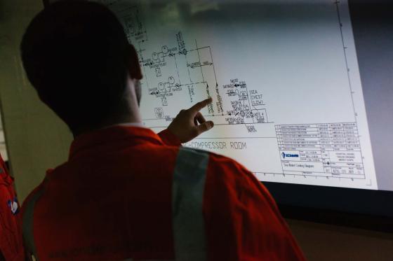
The main output of hydrographers’ work are nautical charts, tidal predictions and volume calculations (e.g. for dredging purposes). These data collected on the world’s oceans, seas and rivers have many applications that are indispensable to the merchant marine, offshore activities, dredging, environmental and underwater projects. This specialized work is carried out by a hydrographic surveyor. He will not only be involved during the preparatory activities but also during the data processing and the follow- up actions.
The Hydrography Cat. B programme is the only of its kind in Belgium. The Institute for Hydrography (IVH), created within the Antwerp Maritime Academy facilitates its organization. The collaboration between the Antwerp Maritime Academy and Ghent University results in a unique concentration of combined knowledge and experience.
The emphasis of the Hydrography B programme lies/is based on a solid theoretical framework, complemented by practical and hands-on experience. For the Integrated Fieldwork and the Field Training, the IVH relies on its partners from governmental organizations and the industry: the Agency of Maritime and Coastal Services (MDK), The Flemish Hydrography, Flanders Hydraulics Research, DEME, GEO-xyz, Jan De Nul, …
After a successful completion of the Hydrography B postgraduate courses and the accomplishment of the Field Training, students will get a Hydrographic Surveyor cat. B certificate from the HZS.
Before you start
Before you start your journey into the captivating field of hydrography, it's essential to ensure that you meet the minimum qualifications for eligibility. To be considered for admission into the Hydrography B programme, candidates should possess the following credentials at a minimum:
- Scientific bachelor's degree or equivalent
o Good knowledge of mathematics: differential and integral calculus, matrix algebra, coordinate geometry (2 and 3 dimensional), spherical trigonometry, theory of errors, functions, series, complex variables, …
o Good knowledge of physics: units of measure, mechanics, signal modulation, measurement of time, electricity and magnetism, optics, transducers, pressure, electronics
- Good knowledge of English
o Fluency in English is a prerequisite for the Hydrography B programme, as all courses are conducted in English.
Interesting program
An interesting program that makes you familiar with the practices of hydrographic surveying and helps you in networking with major companies.